SWAT-GHG is sub routine developed to predict nitrous oxide (N2O) and di-nitrogen (N2) emissions from agroecosystems. SWAT-GHG was developed by defining a set of reduction functions based on soil and environmental factors. The soil conditions include nutrient content (NO3, NH4 and total soil C) and soil pH, while the environmental factors (precipitation and temperature) control the soil temperature and soil moisture conditions. The sub model was developed by linking to modified carbon routine (C-Farm) and predicts N2O, and N2 emissions at the HRU (hydrologic response unit) level.
Reference: Wagena, M.B., A.R. Sommerlot, E.M. Bock, D.R. Fuka, and Z.M. Easton. 2017. Development of a nitrous oxide routine for the SWAT model to assess greenhouse gas emissions from agroecosystems. Environ. Model. Software. http://dx.doi.org/10.1016/j.envsoft.2016.11.013.
The VT BCube EcoHydro-Broker is a NSF funded EarthCube data brokering interface that provides data sources in common formats used for watershed modeling and spatial analysis. The BCube Broker searches data stores in a user defined search space (e.g., bounding box, watershed extent, etc), displays data available for the search domain, and performs common geoprocessing tasks, such as re-projecting, clipping and mosaicing.
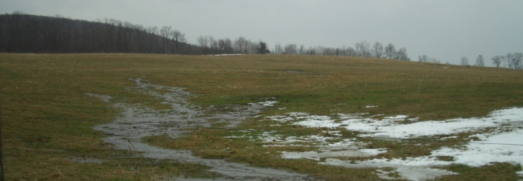
Hydrologically Sensitive Area- Decision Support System (HSA-DSS)
The HSA-DSS tool provides 24-96 hr forecasts of the extent of saturated soils for the South Fork of the Shenandoah river watershed. The HSA-DSS can be used buy agricultural producers to adjust the timing and location of farm management activities, such as manure or fertilizer application, to avoid saturated soils. This can help to improve water quality and provide increased flexibility for farm management.
Reference: Sommerlot. A.R., M.B. Wagena, D.R. Fuka, and Z.M. Easton. 2016. Coupling the short-term Global Forecast System weather data with a variable source area hydrologic model. Environ. Model. Software. http://dx.doi.org/10.1016/j.envsoft.2016.09.0081364-8152.
The getMet library in R provides sourcing and formatting of meteorological data for hydrologic modeling applications. Currently, CFSR data in SWAT model format is supported. Check out the documentation for more info.
To install the package R 3.0.0 or greater is required. The install procedure is shown below.
######################################
# In R run the following commands:
install.packages(‘getMet’)
library(getMet)
######################################
CFSR: Climate Forecast System Reanalysis
NEW UPDATE: CFSR data now available through July 2014. The CFSR dataset consists of hourly weather forecasts generated by the National Weather Service’s NCEP Global Forecast System. Forecast models are reinitialized every 6 h (analysis hours = 0000, 0600, 1200 and 1800 UTC) using information from the global weather station network and satellite-derived products. At each analysis hour, the CFSR includes both the forecast data, predicted from the previous analysis hour, and the data from the analysis utilized to reinitialize the forecast models. The horizontal resolution of the CFSR is 38 km. This dataset contains historic expected precipitation and temperatures for each hour for any land location in the world. Moreover, as the precipitation is updated in near-real time every 6 h, these data can provide real-time estimates of precipitation and temperature for hydrologic forecasting. Our site has had over 65,000 downloads to date. See where people are using it: CFSR Map
Reference: Fuka, D.R., C.A. MacAllister, A.T. Degaetano, and Z. M. Easton. 2013. Using the Climate Forecast System Reanalysis dataset to improve weather input data for watershed models. Hydrol. Proc. DOI: 10.1002/hyp.10073.
Topography exerts critical control on many hydrologic, geomorphologic, and environmental biophysical processes. In order to properly model such dynamics in the Soil and Water Assessment Tool (SWAT), we explicitly integrate topography into the initialization procedure with a purpose-built extension. This ArcMap® toolbox (TopoSoil) interfaces directly with ArcSWAT, to create multiple SWAT data layers, update the SWAT databases and generate the lookup tables required by the model. User defined data layers are processed in a single-step toolbox and include, aspect, elevation, and topographic index (TI), which are then intersected with the vector FAO Global Soils dataset. The toolbox then builds a soil raster layer at the resolution of the project’s base Digital Elevation Model and creates the ArcSWAT required ‘usersoil’ database table along with the corresponding soil lookup table required to map the specific raster soil values to the soil parameters in the ‘usersoil’ database table. This toolbox effectively creates a new soil dataset that incorporates topographic features. This standardized method and toolset allows SWAT modelers to easily incorporate topographic features they believe are important for their catchments without requiring any changes to the current ArcSWAT initialization system. Some of the topographic features may be necessary for process-based routines that one may want to incorporate into SWAT, e.g., energy-budget snowmelt modeling. However, such routines will need to be added to the SWAT model source code. This SWAT toolbox adds flexibility to SWAT modeling with little extra effort on the part of modelers. TopoSWAT_Latest.zip contains the entire package. Users can also download individual modules.
The EcoHydRology package is a collection of useful functions related to hydrology and earth systems implemented in R. Functions which are implemented in the package include:
Radiation Approximations based on temperature:
Since we often only have temperature and precipitation data for a site, we have put together some functions that allow us to approximate terrestrial radiation based on more easily-accessible data such as daily temperature, latitude, day of the year (Jday), and geographical parameters such as:
- Aspect and forest cover
- Solar radiation, including potential solar radiation at the edge of the atmosphere
- Atmospheric transmissivity
- Atmospheric and Terrestrial longwave radiation
Modeling important hydrologic processes based on radiation.
We use the radiation approximation functions to help us estimate important hydrologic processes:
approximating snow melt: SnowMelt
potential evapo-transpiration (PET) using the Priestley-Taylor (1972) method: PET from Temp
Producing simple hydrological output:
Making a hydrograph: hydrograph
Baseflow separation: BaseflowSeparation
Data Collection:
Access reanalysis of NCEP (National Centers for Environmental Prediction) output: get_cfsr
Legacy Hydrology Packages
SWATmodel (see below)
MODFLOW (in development)
A multi-OS implementation of the popular USDA-ARS developed SWAT model in R, which allows SWAT to be widely distributed and run as a linear-model-like function on multiple OS and processor platforms. This allows researchers anywhere in the world using virtually any OS to run SWAT. In addition to simplifying the use of SWAT across computational platforms, the SWATmodel package allows SWAT modelers to utilize the analytical capabilities, statistical libraries, modeling tools, and programming flexibility inherent to R.
The SWATmodel package we developed provides a linear-model-like R interface to the SWAT modeling system, transforming weather data through a multi-parameter modeling space into a hydrological output response. A valuable feature of R analysis packages is their ability to work on most OS and system architectures. SWATmodel contains the public domain SWAT FORTRAN code, slightly modified to be GNU, multi-architecture, FORTRAN compiler compliant. This way CRAN can confirm compliance, compile binaries, and distribute the SWAT model for most Operating Systems.
Reference: Fuka, D.R., M.T. Walter, C.A. MacAllister, and Z.M. Easton. 2014. SWATmodel: A Multi-OS, Multi-Platform SWAT Model Package in R. J. Am Water Res. Assoc. 1-5. DOI: 10.1111/jawr.12170.